Pour contacter l’auteur/to contact the author:
Courriel/email: eylapointeACOMMERCIALgmailPOINTcom / eylapointeATgmailDOTcom
About this blog:
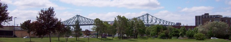
Le Coeur du Quartier (a.k.a. Le Coeur de Sainte-Marie) is a blog about me (Eric), along with my dog Elliot, and our explorations through the eastern portion of the Centre-Sud neighbourhood in Montreal (within the Ville-Marie borough). The eastern portion of the neighbourhood is known as Sainte-Marie. The original raison-d’être of this blog was to find the name of the area as I could not get a straight answer to this question. In addition, I was searching for the “heart” of the neighbourhood as the Centre-Sud area seemed to be divided into smaller pieces and it was harder to find a community to attach myself to at first. Please click here for the first original post to see how this got started.
I have since chosen to begin writing articles about the neighbourhood in French on the new web portal Centresud-Montreal.com (which includes both the St-Jacques and Sainte-Marie micro neigbourhoods) but this blog will continue in an English language diary style when doing local historical research or simply talking about my everyday life in Sainte-Marie and Montreal.
About Sainte-Marie (modern-day definition):
From a technical standpoint, the modern-day boundary lines of Sainte-Marie are Papineau to the West and the CP rail lines to the East. The St-Lawrence river to the south and Sherbrooke St. East to the North. The name Sainte-Marie is actually an old name with a deep history but boundary lines have changed over the years which have led to much confusion and, one could argue, an identity challenge. The Centre-Sud neighbourhood was born just outside of the fortified walls of what is now known as Old Montreal. Its first names were Faubourg Québec and Faubourg Sainte-Marie. This neighbourhood slowly stretched out to where the Sainte-Marie rapids are (near De Lorimier St.). Then the city of Montreal eventually created wards that ran north-south. One of these wards was also labeled Sainte-Marie and according to one 1875 map, it ran from Visitation to the West to roughly Iberville to the East. Meanwhile, this original ward ran north of Sherbrooke towards Rachel St. and east of Iberville was known as Hochelaga (today it begins at the CP rail lines). Part of this website’s goal is to find the history of how the neighbourhood has generally evolved overtime which includes looking at significant events that has shaped the area.
The other mission of this website is be to do further research on the present and future of Sainte-Marie. Sainte-Marie is part of a revitalization program so it will be interesting to see if the neighbourhood can evolve while maintaining affordable housing and continued access to important services for its all of its citizens.
About the Author (me):
I have a tumblr if you want to know more: eylapointe.tumblr.com
Disclaimer: The above was written based on memory from various research findings. All individual blog pieces list sources so please refer to these books/websites for accurate information as this website is a diary documentation of my research. All writing and photos (unless they clearly look historical or are credited otherwise) are (c) Eric Y. Lapointe 2008, 2009 and 2010. Please ask for permission to use any text or photos from this website.
