As promised, I wanted to give everyone a quick blog on the Centre-Sud/Sainte-Marie neighbourhood and what has divided it over the years. I’ll hopefully have time at some point in the future to examine each point in more detail but it was important for me to sum things up in a nutshell, as an introduction, based on different readings and discussions.
It seems to me that Centre-Sud and Sainte-Marie were once considered the same area. The very first name of the neighbourhood was Faubourg Québec (Faubourg means an inner-city suburb). Early maps show that this was right outside of the Ville Marie fortified walls (where now stands new condos advertising “Old Montreal” and all the way to the Molson brewery). The name of this neighbourhood was later labeled Faubourg Sainte-Marie. Once you throw in decades of different municipal wards, neighbourhoods and boroughs, the info beyond this gets quite confusing but it can be concluded that Sainte-Marie was the name that was used for the Centre-Sud district at one point or another. Sainte-Marie and it’s lines stretched eastward over time. The actual “Sainte-Marie Ward” in the late 1800s only stretched toward Iberville or De Lorimier depending on what map you look at today, according to borough lines and “Sainte Marie Mon Quartier” (a 2002-2005 Montreal city urban revitalization plan), it stretches out all the way to the CP train tracks. So when you think about it, it’s actually quite pertinent that people use the term “Centre-Sud” (i.e. South Central Montreal which is not an officially recognized district) when describing this whole area as its something that joins this area, that has had way too many names and municipal labels over the years, together.

Anyhow, back to the divisions of Centre-Sud and Sainte-Marie, here are four major events I have come across that have caused a divided neighbourhood over the years:
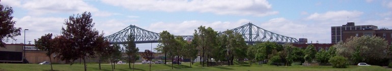
1 – The Jacques Cartier bridge (completed in the early 30s). As it needed to stand tall in order to let large ships pass under it, this also meant that the bridge had to go deep into the neighbourhood to begin its climb. A great deal of homes needed to be expropriated for its construction and not to mention that the structure itself was a visible barrier and cut the area in two.
")
2 – The new CBC HQ building. A number of blocks and 5000 homes had to be expropriated in order to create 1 building and a parking lot. I have discussed this before so enough said for now.
3 – Expo 67 Traffic. In order to make it easier to get on and off of the Jacques Cartier bridge faster and easier, Papineau and De Lorimier became one-ways with this idea in mind. Any financial advantage that the Jacques Cartier used to provide to local businesses and restaurants in the area with the south-shore traffic was simply over. These new one-ways directed traffic quickly through and out of the neighbourhood towards the more prominent Saint-Louis district (i.e. the Plateau). Note: I am not sure what the story is about Iberville and Frontenac but they are also long roads used as one-ways which simply feels like knives dividing today’s modern Sainte-Marie neighbourhood.
4 – The 1974 Fire Department Strike. Apparently this neighbourhood was the hardest hit of all. You can see this visibly with “pocket parks” which are in the middle of homes on residential streets as well as unique one-story shack-like homes here and there where you would expect to find duplex and triplex row housing

